THE LIMES ARABICUS WAS A DEFENSIVE LINE THAT FORMED PART OF THE WIDER ROMAN LIMES SYSTEM, DEMARCATING THE BORDER OF THE ROMAN PROVINCE OF ARABIA PETRAEA TO THE FRONTIER LANDS OF ARABIA, KNOWN AS ARABIA MAGNA AND ARABIA FELIX.
Arabia Petraea was a frontier province from the 2nd century AD, that included the former Nabataean Kingdom in Jordan centred on Petra, the southern Levant, the Sinai Peninsula, and the north-western Arabian Peninsula.
A major trading route called the Via Traiana Nova or Via Nova Traiana (meaning ‘Trajan’s New Road’) was constructed by the Emperors Trajan and Hadrian to stabilise Arabia Petraea and facilitate troop movement and commerce.

Some scholars argue that the Limes Arabicus served to mainly monitor and control nomadic desert tribes, but the military function is clearly also linked to the economic and political control of natural resources such as water and seasonal pastureland.

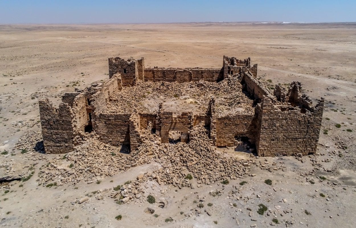
Qasr Bashir – Image Credit : Christopher Sprake – Shutterstock
During the Severan dynasty (AD 193–235), the frontier was reinforced with castra (forts), mainly centred in the strategic Wadi Sirhan region in the north-western Arabian Peninsula that served as a gateway for trans-Arabian trade.
During the 3rd to 4th century AD, a system of castella, watchtowers, and fortresses were constructed at intervals of every 100 kilometres (62 miles), such as the fortresses of Qasr Bshir, Qasr eth-Thuraiya, Qasr el-Al, Qasr Abu al-Kharaqah, el-Lejjun, Jurf al-Darawish and Da’janiya.
Troops were progressively withdrawn from the Limes Arabicus in the first half of the 6th century and replaced with native Arab foederati, chiefly the Ghassanids until they were overrun during the war with the Sasanians in AD 611.
After the Muslim Arab conquest, the Limes Arabicus was largely left to ruin, though some fortifications were used and reinforced in the following centuries.
Src: heritagedaily.com


